


Geographic Information System (GIS)
A geographic information system (GIS) is any manual or computer based set of procedures used to store and manipulate geographically referenced data. The definition of a GIS is a computer-based system that provides the following four sets of capabilities to handle georeferenced data:
- Data input;
- Data management (data storage and retrieval);
- Data manipulation and analysis; and
- Data output (mapping or reports)
SSMRCA GIS Background
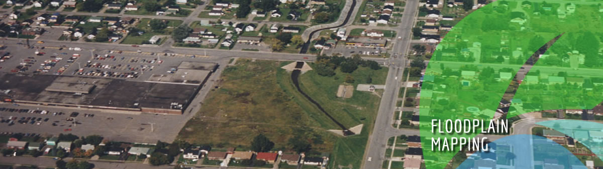
In 2005 the provincial initiative for ‘capacity-building’ within the Conservation Authorities involved the addition of staff, the upgrading of computer equipment and software to enable the use of GIS in the day to day operations. This initiative was to facilitate the watershed based drinking water source protection mandate under The Clean Water Act, 2006. This capacity building exercise has upgraded the resources to fulfill the SSMRCA mandate under ‘Ontario Regulation 176/06: Regulation of Development, Interference with Wetlands and Alterations to Shorelines and Watercourses’ and supporting the Drinking Water Source Protection Program under The Clean Water Act, 2006. Future initiatives of this Conservation Authority will benefit as data on the local area is accumulated and integrated with current data. GIS services provide digital spatial information for the Drinking Water Source Protection Program, Conservation Authority hazard areas and flood plains (fill regulated areas) in accordance with ‘Ontario Regulation 176/06: Regulation for Development, Interference with Wetlands and Alterations to Shoreline and Watercourses’ (2006), the Flood Plain Mapping Report (Dillon, 1977) and the Shoreline Management Plan (early 1990’s) for the Sault Ste. Marie Region Conservation Authority area. Until funding becomes available information within the conservation authority watershed will remain static.
Other related areas that SSMRCA GIS is used for are:
- Protect Life and property from flood and erosion (O. Reg. 176/06)
- Encourage Sustainable Water Supply (Drinking Water Source Protection, The Clean Water Act, 2006)
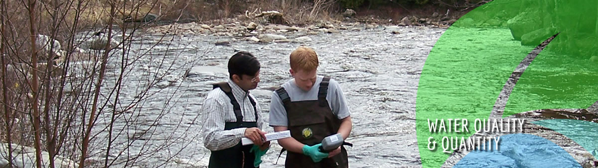
- Inventory and Monitoring water quality (PWQMN, Drinking Water Source Protection)
- Assess and Report on Water Conditions (Recreation, Flood, Drinking Water Source Protection)
- Protect / Enhance Water Quality (Drinking Water Source Protection)
- Provide Recreation/quality of life opportunities (Recreation, Drinking Water Source Protection)
The objective of GIS within the Conservation Authority is to provide spatial analysis in a world-referenced view of the Conservation Authority data. In the day to day operations such as development inquiries and applications for permit under ‘Ontario Regulation 176/06: Regulation for Development, Interference with Wetlands and Alterations to Shoreline and Watercourses’ the GIS software provides a localized map to reference. The ongoing gathering and organizing of data for the use in Drinking Water Source Protection Planning and future implementation that may be supported by GIS software and the other water models will determine the flood plain, fill regulated (hazard land), catchments and watershed basin areas for future planning.
GIS services use analytical and spatially referenced data that has been produced by Conservation Authorities, Municipal, Provincial or Federal governments. The data is then used in the analysis and mapping of the area features. These features include geology (bedrock, quaternary), natural resources, hydrology (lakes, wetlands, streams and rivers), cultural (communities, parks), infrastructure (roads, rail etc.) and soils.
The SSMRCA GIS service is provided to assist stakeholders such as municipal, provincial, federal governments and the public. Currently partnerships exist for the exchange of information with the City of Sault Ste. Marie, Township of Prince, the Sault North Planning Board, Ministry of Natural Resources (MNR), Ministry of Environment (MOE), Ministry of Health and Long-Term Care (MOH) and membership in Ontario Geospatial Data Exchange (OGDE).
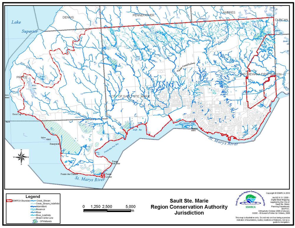
Areas of Jurisdiction
 |
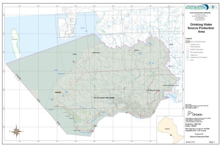 |
| SSMRCA's area of jurisdiction | Source Protection Area |
The defined Sault Ste. Marie Region Source Protection Area as designated under the Drinking Water Source Protection Program of the Clean Water Act, 2006 includes the entire Root River system (along with Black Creek, Canon Creek, Crystal Creek, West root river and Coldwater Creek), Little Carp River, Big Carp River, Bennett Creek, East Davignon Creek, Central Creek, West Davignon Creek and Fort Creek watershed basins, all of Prince Township, the Batchewana First Nation (Rankin Reserve) and City of Sault Ste. Marie, portions of Dennis, Pennefather, Awares, Jarvis and Duncan Townships and the western portion of Garden River First Nation. This has been defined scientifically with the assistance of the Ministry of Natural Resources and Forestry, Peterborough Geomatics Centre. Within the Townships of Prince and Dennis the area includes the shoreline of Lake superior from the Thielman Creek waterbasin to Gros Cap and along the international border.